
G Line delivers a modern Richmond Station with wider platforms, more entry points, and full DDA compliance.
G Line rethinks the experience of moving through Richmond. It delivers a modern Richmond Station, clearer connections between trains, trams, buses, walking and cycling, and safer separation between different modes of transport.
The aim is to remove the congestion, confusion and conflict people experience today and create a journey that is faster, easier and far more intuitive, whether you are commuting to work or attending an event.
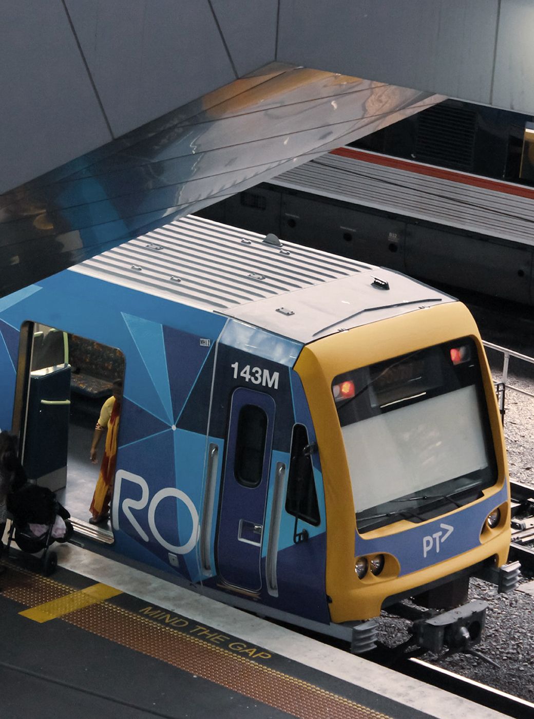
G Line reworks the rail corridor between William Barak Bridge and Cremorne — divided for over a century — into new urban space. Combining rail, road and active transport works into a single construction program, it’s an innovative approach for a project this size in Melbourne.
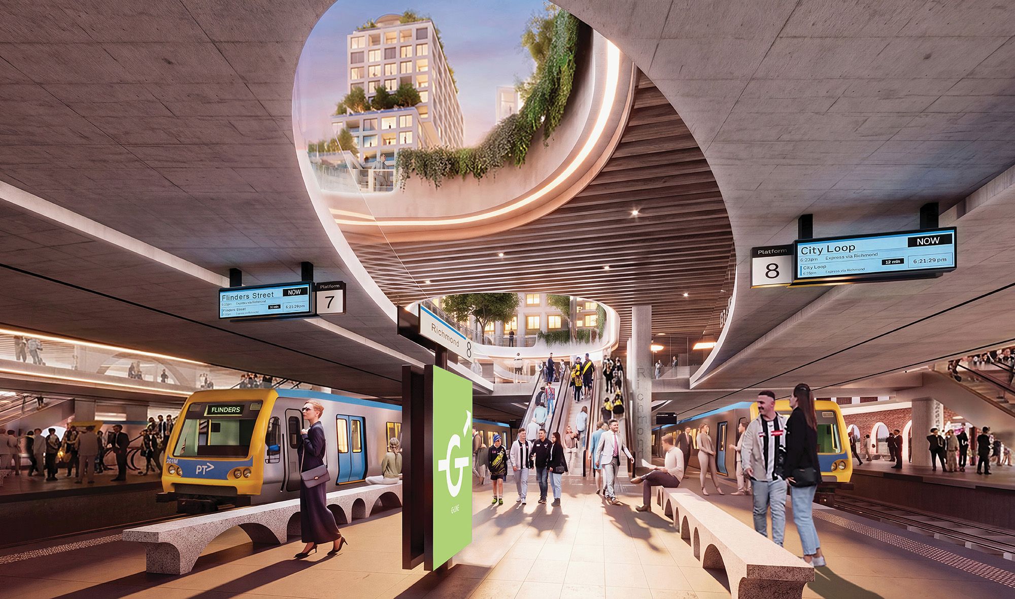
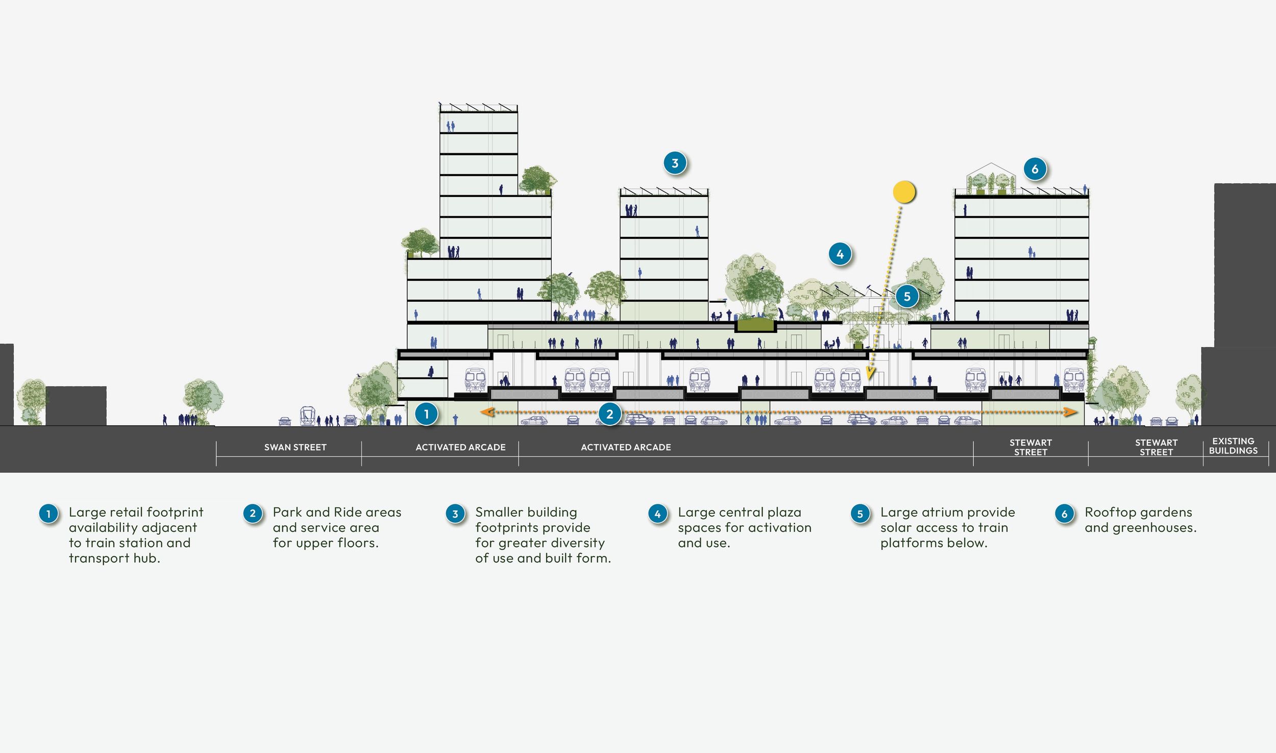
A vertically layered system gives each mode its own level, rather than competing for the same ground. At its centre, Richmond Station gains wider platforms, more entry points, and full DDA compliance. Delivered while trains keep running throughout construction.


1/4
70%
4million
9carriages
Wider, longer platforms enable wide-ranging tram and full DDA access, with new entry points that replace the single, congested Barassi Way approach — signalling quality and orientation from the first step off the train.
The station stays open throughout the build. Platforms freed up by the Metro Tunnel’s re-routing of Pakenham and Cranbourne trains make room for a dedicated events platform, plus increased V-Line and freight services.
A dedicated events platform and an expanded bus interchange help clear crowds faster and support additional services on major event days — addressing pinch points like the MCG’s southern concourse, where patrons currently travel uncontrolled in either direction, and the narrow footpath near Melbourne Park at Richmond Station.
A new podium level bridges the rail corridor, replacing seven competing modes with clearly separated movement for each — giving direct access to Richmond Station, tram stops and bus stops, while a direct link to the William Barak Bridge extends that connection through to the CBD.
An elevated concourse and a new “Halo” walkway remove the at-grade crossing of Punt Road and Swan Street, making the precinct fully traversable on foot in every direction.
A new east-west route through the precinct closes a longstanding gap, linking Strategic Cycling Corridors and adding a diagonal connection Melbourne’s street grid doesn’t currently offer.
The Olympic Boulevard tram stop relocates 150m west, cutting the walk to AAMI Park from 250m to 100m.
A two-bay bus interchange on each side of Punt Road replaces single-bay stops, with direct access to Richmond Station.

1/3
Richmond Station handles 3.7 million boardings a year, but it wasn’t built for this. The west entrance is only open on event days, and after a big match at the MCG, crowds back up along Barassi Way and onto a single shared walkway that serves every platform — so congestion at one spreads to all of them. The platforms themselves aren’t wide enough, long enough, or accessible to everyone.
G Line extends the platforms to the south and west, enabling nine-carriage trains and new access points straight from the concourse, including DDA access. That spreads crowds across more entry points instead of funnelling them through one, and gives regular commuters more ways in as the surrounding precinct grows.
The construction process allows the station to continue operating while building over the top, limiting disruption to commuters. Once complete, platforms freed up by the Metro Tunnel re-routing make room for a dedicated events platform, plus increased V-Line and freight services.
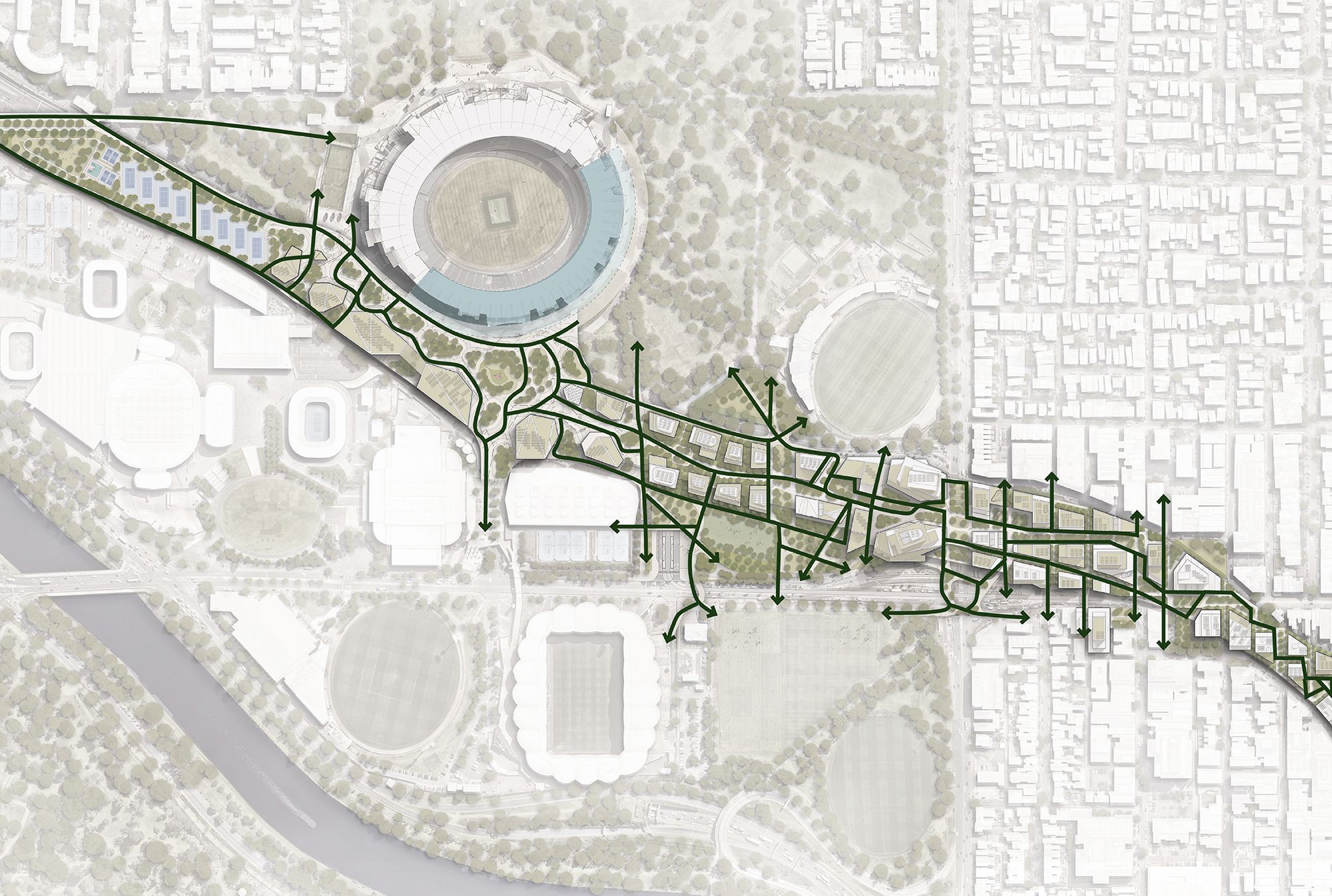
The rail corridor, Punt Road and Swan Street currently divide the precinct into disconnected pockets, with crossing points only every 200–220m. On event days, patrons queue and overflow onto Swan Street and Punt Road, and Barassi Way closes to traffic just to let people through.
G Line replaces this with a continuous elevated network — a covered concourse linking Cremorne to Richmond Station, a new Halo walkway over the intersection of Punt Road, Swan Street and Olympic Boulevard, and direct paths between Richmond Station, Melbourne Park and Yarra Park. A separate pedestrian bridge from Olympic Boulevard adds a new north–south connection to AAMI Park, with further opportunity to link directly to Melbourne Park — easing queuing during the Australian Open.
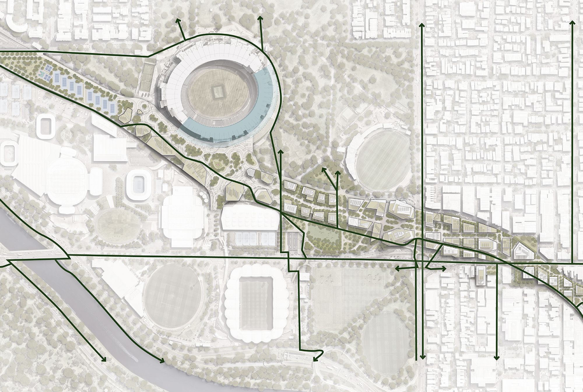
Swan Street is meant to be a key east–west cycling corridor. Right now it can’t fit trams, pedestrians and cyclists at once, leaving a gap in the network between Cremorne, the Swan Street underpass and Church Street. G Line closes that gap with a new east–west cycling route through the precinct, giving the grid a diagonal connection. It links directly to the William Barak Bridge and the Capital City Trail, with further opportunity to connect east to Richmond Station.
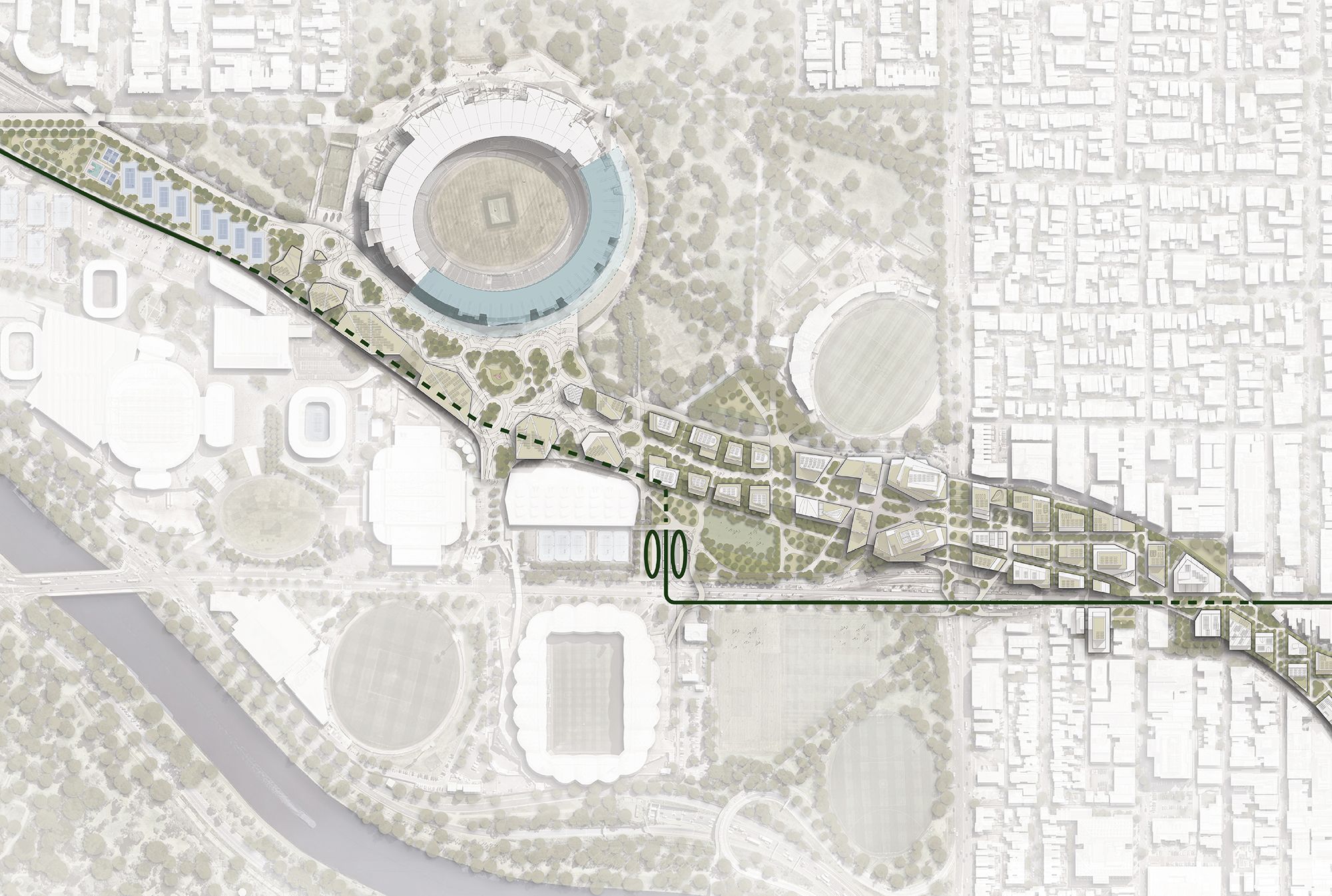
The Olympic Boulevard tram stop currently sits 250m from AAMI Park via a signalised crossing — a location with little passenger use. G Line relocates the stop 150m west, cutting the walk to AAMI Park and connecting it via a new overpass. Access to Richmond Station improves from both platforms, tying trams more clearly into the wider interchange. The move removes a hold line from the Punt Road/Swan Street intersection, improving tram flow, and integrates the stop into the design of the precinct.

The Punt Road/Swan Street intersection is one of Melbourne’s biggest pedestrian bottlenecks — high-traffic, limited storage space, patrons spilling onto the carriageway during big events. Cyclists face the same conflict, competing with vehicles at the same crossing.
The Halo is a grade-separated walkway lifted above the intersection. It connects Richmond Station and the MCG entertainment precinct directly to the sports precinct, without pedestrians or cyclists crossing at grade. Both groups get faster, safer movement, with travel time savings during the interchange’s busiest periods.
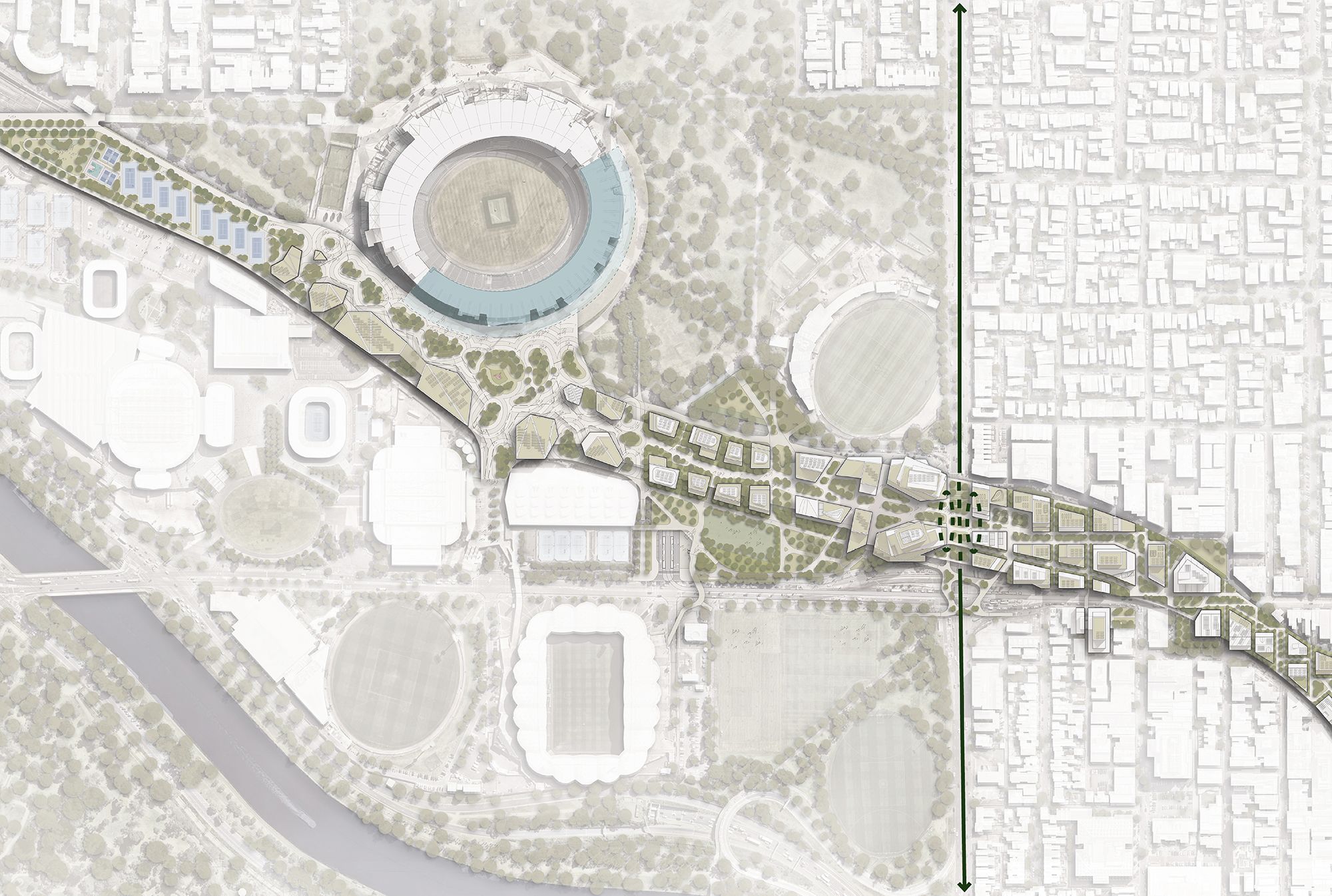
Punt Road is a declared Principal Public Transport Network corridor. One bus service currently serves it — inadequate for the corridor’s connectivity and the crowded surrounding streets outside events. G Line provides a two-bay interchange on both sides of Punt Road at Richmond Station with dedicated bus lanes, giving buses priority movement through the precinct, direct connections to Punt Road and Swan Street, and expands frequency and service. Event-day and tourism bus operations are supported, with parking retained.
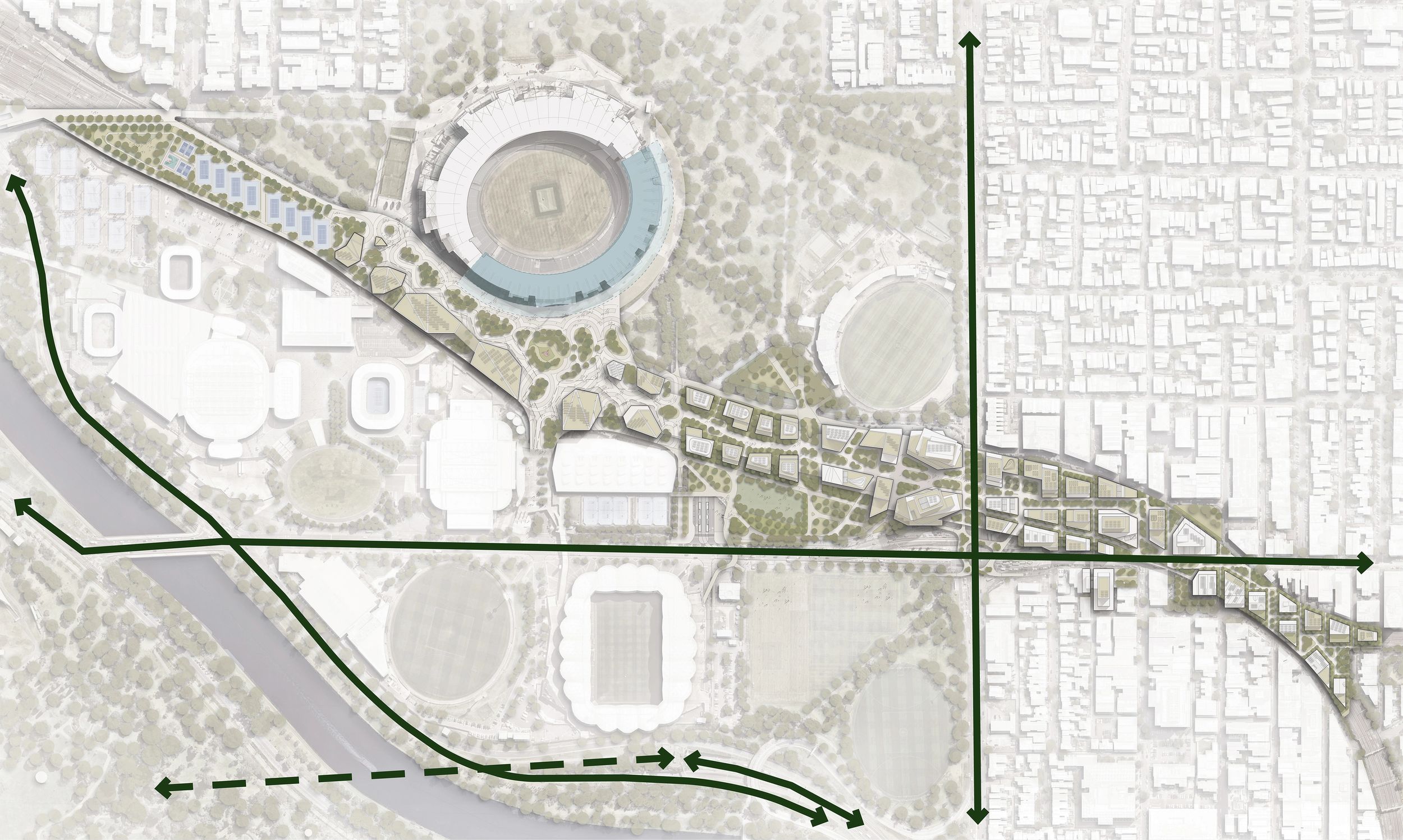
Both Punt Road and Swan Street are declared B-Double routes. However, height restrictions beneath the rail overpasses force some B-Doubled onto various detours. G Line raises vehicle clearance under the overpasses and improves freight connectivity along two key routes on the east side of Melbourne’s CBD.